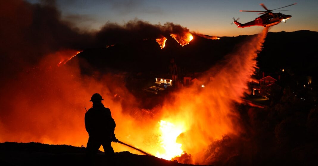
On Tuesday, Santa Ana winds swept seaward through Southern California, scattering embers and then fanning flames of a growing wildfire. By nighttime, residents received urgent text alerts warning of potential 100 mph gusts—a terrifying escalation that transformed a precarious situation into a full-blown crisis. As the winds howled, more embers took flight, sparking new fires in dry, brittle brushlands that hadn’t seen significant rain in over eight months.
Los Angeles County, primed by drought-like conditions, was a tinderbox waiting for a spark. Firefighters faced an uphill battle against winds so severe that airplanes used to drop water and flame retardants were grounded. Officials warned in a Wednesday morning press release that “all residents of Los Angeles county are in danger.” Evacuation orders have since displaced tens of thousands of residents, with thousands more awaiting updates. By Wednesday evening, three major fires had consumed over 13,000 acres with containment efforts lagging: The Palisades Fire in Pacific Palisades and Malibu, Hurst Fire in Sylmar, and Eaton Fire near Pasadena have showed no signs of slowing down, are at the time of writing 0 percent contained, and have already become the most destructive in California history.
The fires turned catastrophic so quickly because of unusually dry and windy conditions: “Any little spark, whether from a lightning strike or a person or a campfire is going to quickly, quickly escalate,” says Jennifer Marlon, research scientist and lecturer at the Yale School of the Environment and the Yale Program on Climate Change Communication. “Once a fire starts in these conditions, it’s very, very hard to get under control,” adds Kaitlyn Trudeau, senior research associate of climate science at the nonprofit news organization Climate Central.
Santa Ana winds events aren’t uncommon. “We see it every single year at this time,” says Jason Moreland, senior meteorologist at emergency communications platform AlertMedia. These downhill winds, which originate inland, are caused by a dry high-pressure system coming from the northwest, and a low, humid pressure system from the south. “It’s like if you have a hose and you fold it in half to cut off the water. If you prick a hole in the side, you have a lot of pressure to get out,” explains Trudeau. “That’s basically what’s happening with the air.”
However, these winds are a lot stronger than usual because of a dip in the jet stream near the Baja Peninsula in northwestern Mexico, Moreland explains. Winds that are usually relegated to higher elevations are reaching lower terrain areas. “Every so many decades, we do get wind events of this magnitude,” he says.
While this wind event seems extreme, Noah Diffenbaugh, professor and senior fellow at Stanford’s Woods Institute for the Environment, explained that it might just be due to natural weather variability—and more research is needed to know if it is caused by climate change.
However, while the winds aren’t unseasonal, climate change is increasing the risk of late- or early-season wildfires in California. “This is not only a particularly strong wind event, but is also a particularly dry season here in the beginning of January,” says Diffenbaugh. Southern California’s wet season, which runs from October through April, has seen record low precipitation, following one of the driest falls on record. As precipitation is more variable due to climate change, the overlap between the windy season and the dry season is increasing. “We’re seeing a significant amount of more, hot, dry, windy days, especially in Southern California,” says Trudeau.

